Mineshop Holiday Cottages
Crackington Haven, Bude, Cornwall


History of Mineshop
Mineshop got it's name from two parts, ‘Mine’ after the working Wolframite, Lead and Zinc Mine, which was located in the valley and ‘Shop’ after The Blacksmith’s Shop which operated as a thriving business. The Mine closed down in the early forties and the Blacksmiths Shop sometime in the Fifties.
Our family moved to Mineshop in 1966 and converted and built the cottages soon afterwards, before this the Lee family owned the valley and ran a Market Garden, growing Potatoes, Vegetables, Daffodils and Strawberries, on the whole of the South facing side of the Valley, all of this was before the days of large Farm Machinery and was done solely by hand!
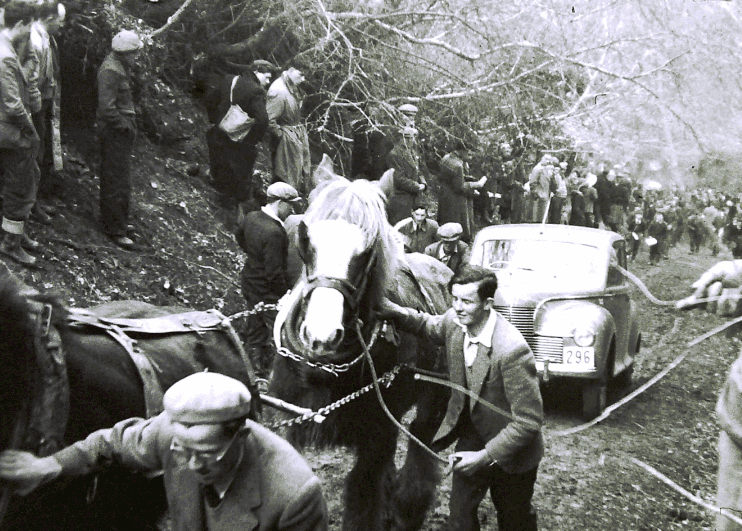
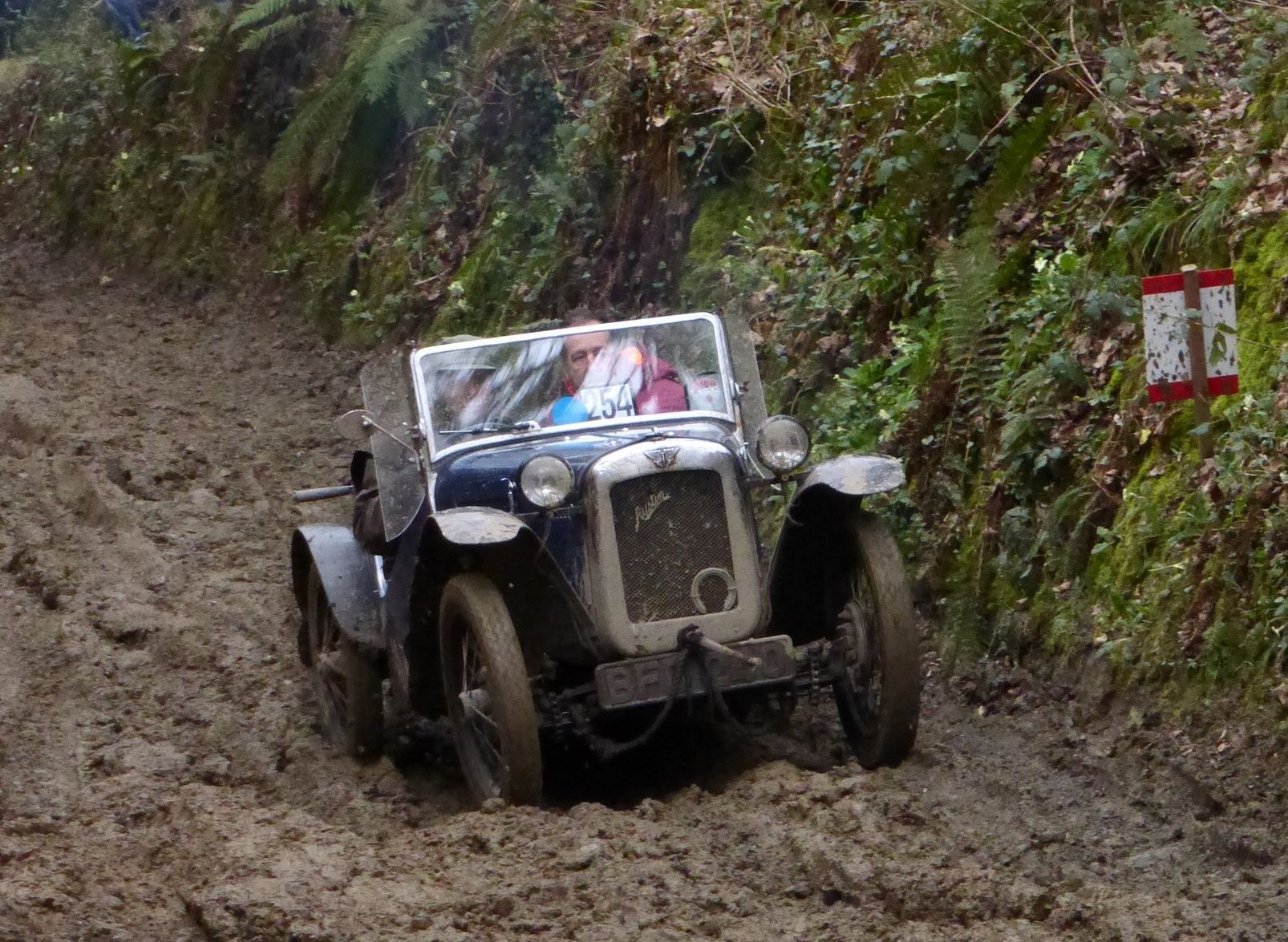
Since 1908 the MMC has held the London to Lands End endurance trial with different classes of motorbikes, sidecars and cars. One of the sections en route to Lands End is 'trial hill' at Mineshop (or as they call it 'Crackington'). It is held every Easter Saturday and is quite a sight!
History of St Gennys
The name St Gennys comes from St. Genesius, the patron saint of the local church, situated at Churchtown on top of the 400ft cliffs overlooking Bude Bay.
The first reference of St Gennys is in the Doomsday Book, however there is evidence of human occupation dating back to prehistoric times.
Agriculture has always been a key industry in St Gennys, but slate quarrying, mining and trade also used to be thriving industries in the area. In its hey-day there were blacksmiths at Mineshop, Churchtown, Cleave, Coxford, Wainhouse Corner, Tresparrett Post, Pencuke and Trevigue. Today there aren't any!
History of Crackington Haven
'Crackington' is a hybrid of Cornish and English 'Crack' means sandstone in Cornish and 'mutha tun' means river mouth farm in English. Located on part of the 600 mile South West Coast Path, Crackington is situated at the mouth of the picturesque valley which leads to Mineshop. It is of great geological importance with its carboniferous rocks, which has even been given the name 'the Crackington Formation', for this reason the area has been designated a Site of Special Scientific Interest (SSSI), as well as an Area of Outstanding Natural Beauty.
Crackington Haven was mainly used for the Quarrying of Slate. Large vessels would come in and beach themselves at mid tide, unload their cargo of limestone & coal, load up with slate taken from the cliffs and on the next high tide they would sail away.
In 1836 plans were drawn up for a scheme to provide harbour facilities at Tremoutha which is just around the corner from the beach at Crackington Haven. The plan was to run a railway line from the northern breakwater up through Crackington and onto Launceston. This would have turned the little village into a new town which was to be called Victoria. Luckily these plans were abandoned leaving Crackington Haven unspoiled and relatively unchanged for centuries.

Wrecks are said to have supplied much of the early building materials in Crackington. The rocky headlands claimed many boats all along the coast. If you walk around the rocks from Crackington Haven Beach to the left at low tide, you may stumble across the last remaining parts of the WW2 S89 German E boat which broke tow whilst en route to Wales and washed up on Tremoutha Haven Beach on 5th October 1946. The engines are still visible for about three hours per day, but please be careful not to get cut off by the tide.
Crackington, along with Boscastle, suffered a great deal of damage in the flood of 16th August 2004. Shops, cafes and homes were flooded, cars washed out to sea, and the bridge suffered structural damage which has since been repaired. Crackington has never seen anything like it before. Seeing the peaceful village now, it is hard to believe that anything ever happened! The Cabin Cafe has a photo album showing the damage that occurred on that day, it is well worth a look whilst enjoying one of their superb coffees.


